Tornado Watch issued for much of Eastern NC
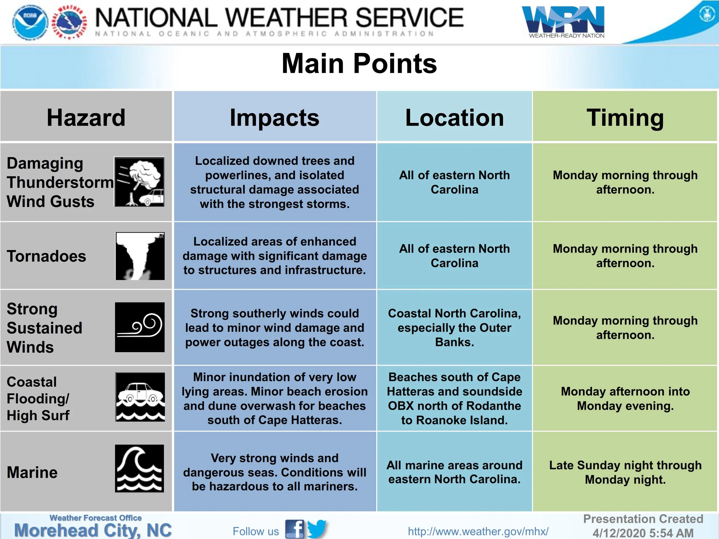
The latest NWS briefing anticipates strong to severe thunderstorms to cross Eastern NC later this morning through this afternoon, with the potential for damaging winds, frequent lightning, hail, and tornadoes possible. The biggest change with this forecast update is a Tornado Watch Issued until 12:00 PM EDT.
PUBLISHED ON SUNDAY 4/12:
The latest NWS briefing regarding the strong cold front that will impact the area Sunday night through Monday is below. The Storm Prediction Center has expanded the enhanced risk for severe weather across North Carolina but the expected impacts have not changed since the last briefing.
Published on Saturday, 4/11:
A strong cold front will impact the area Sunday night through Monday. The Storm Prediction Center has increased the risk for severe weather to enhanced for much of eastern North Carolina, which is rare this far in advance.
Originally published at 10:51 am:
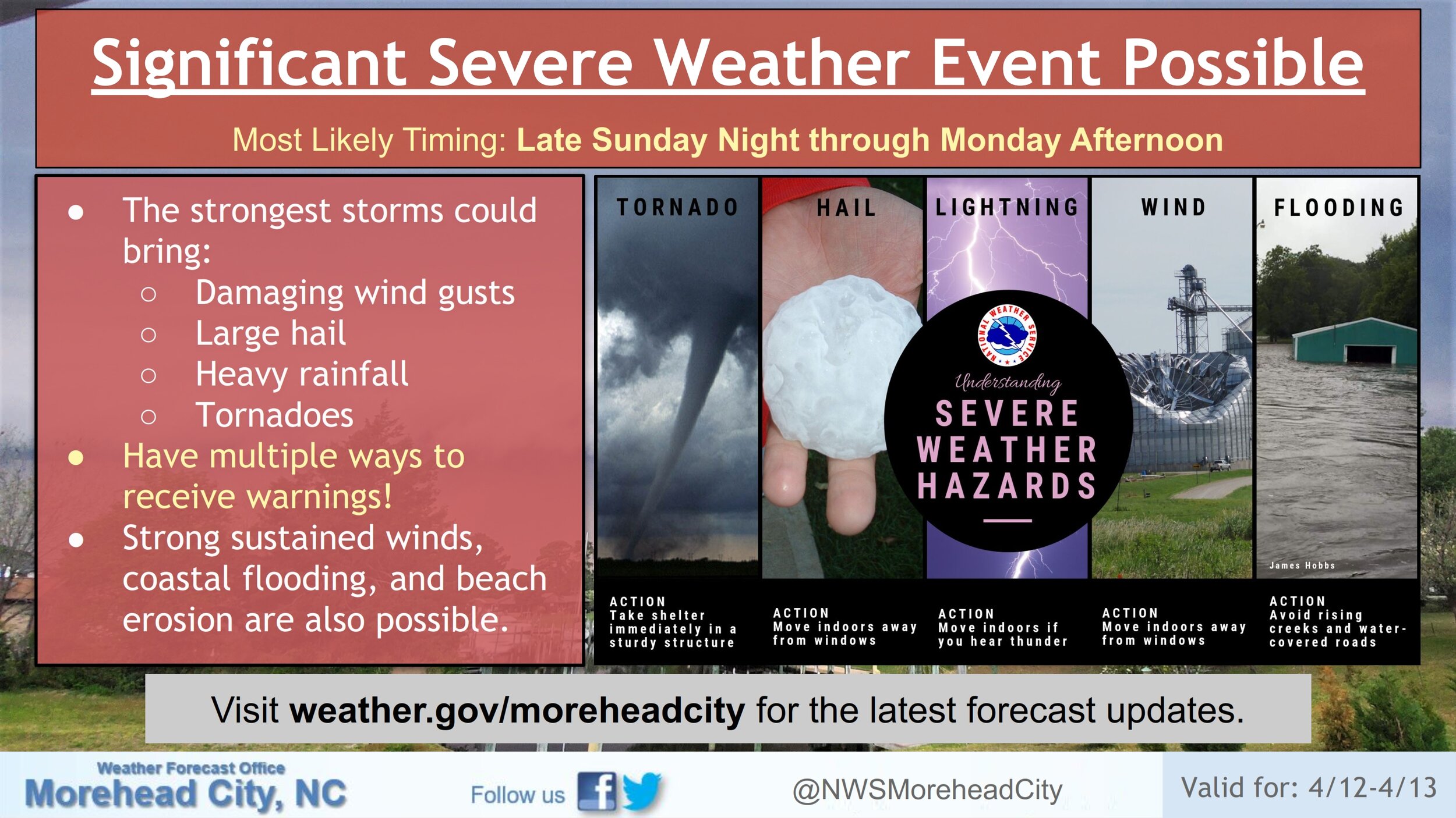
The National Weather Service in Newport/Morehead City continues to monitor the potential for a significant severe weather event late Sunday night through Monday afternoon. The Storm Prediction Center currently has eastern North Carolina under a slight risk for severe weather Monday, but several factors remain uncertain and there is potential for this risk to increase. Additionally, there is growing confidence that strong sustained winds will bring coastal flooding and beach erosion.


