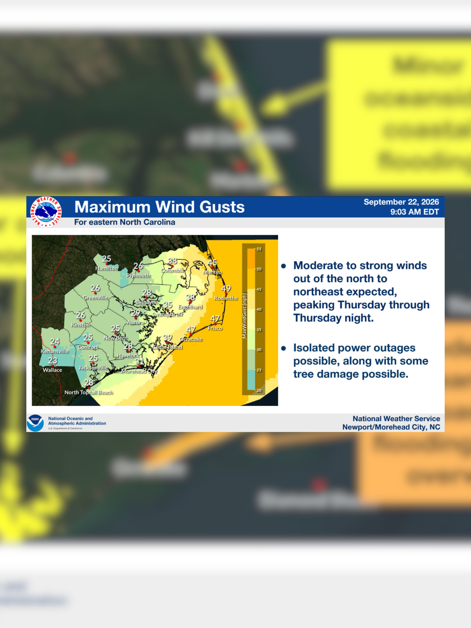
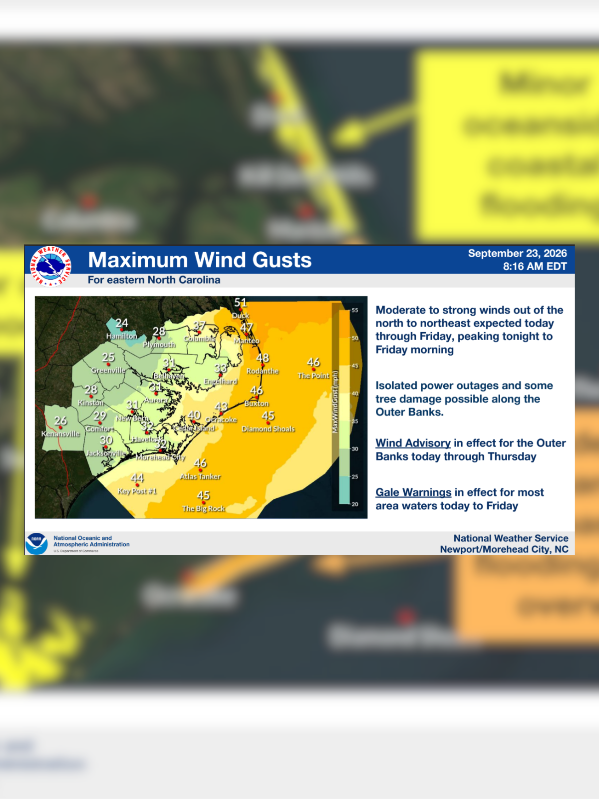
Starting today a coastal low will impact ENC and the nearby marine areas through the end of the week.
All tagged national weather service
Starting today a coastal low will impact ENC and the nearby marine areas through the end of the week.
A coastal low that will impact ENC and the nearby marine areas mid to late week.
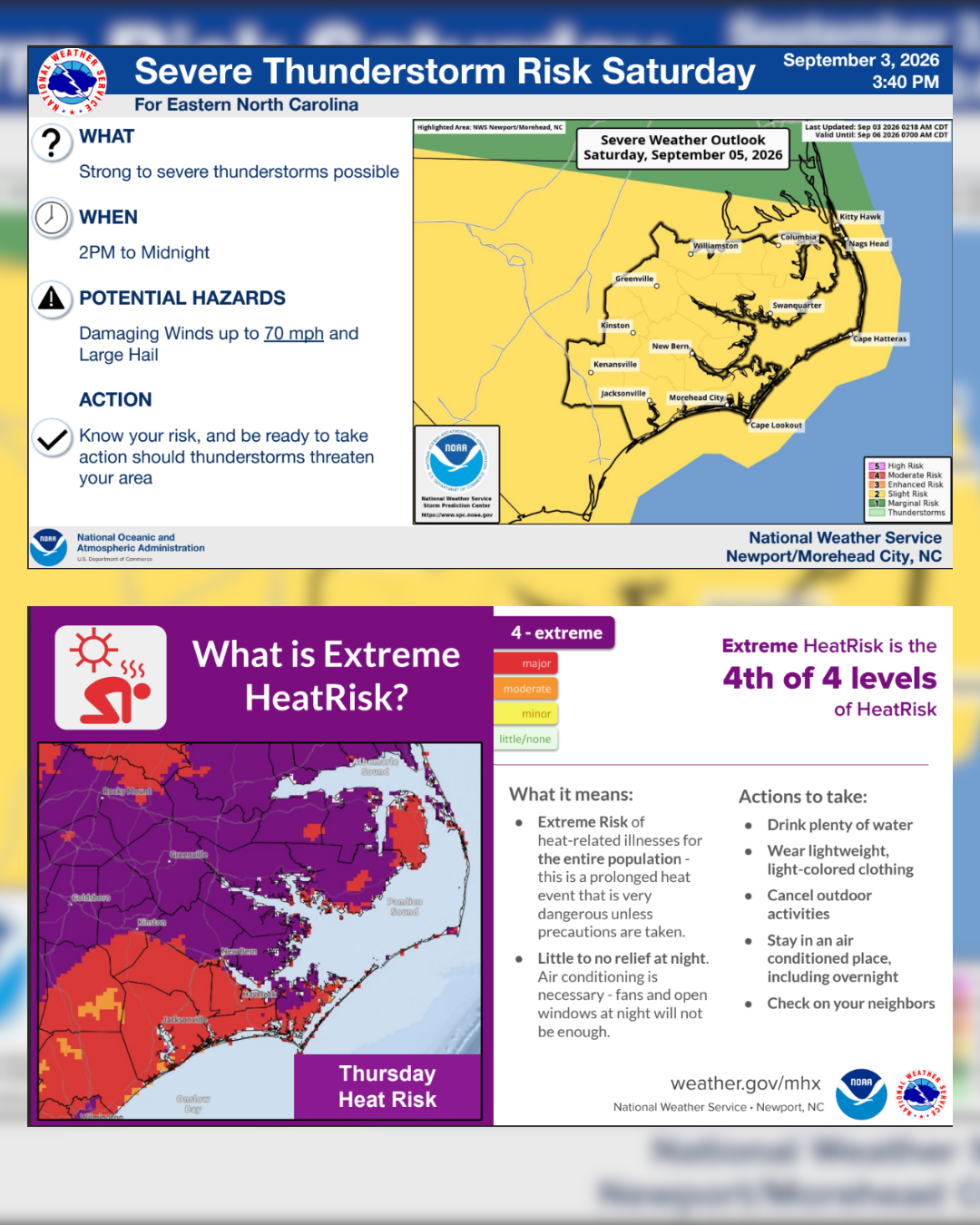
Here is the latest update on heat and severe weather impacts on Friday and Saturday, September 4-5, 2026.
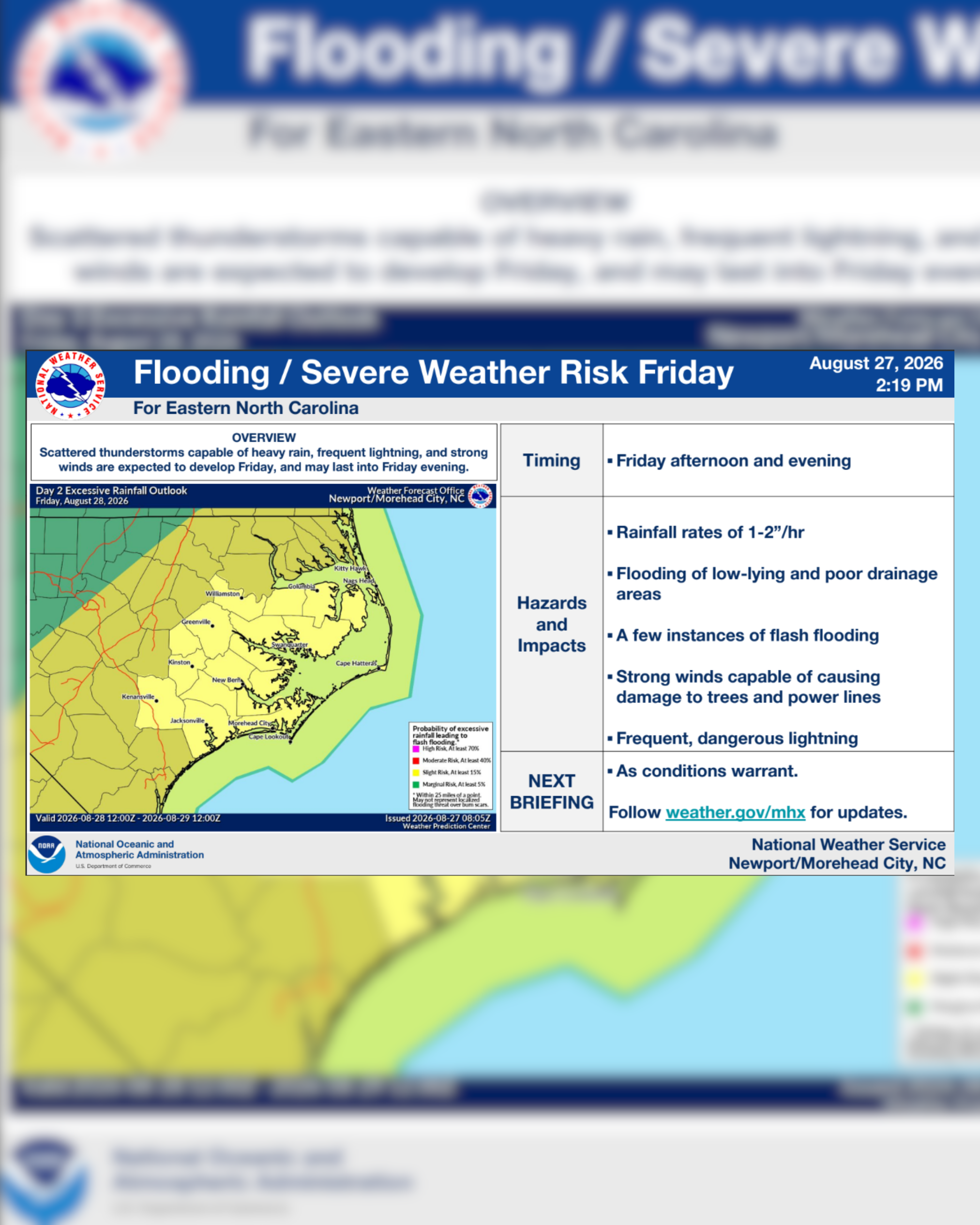
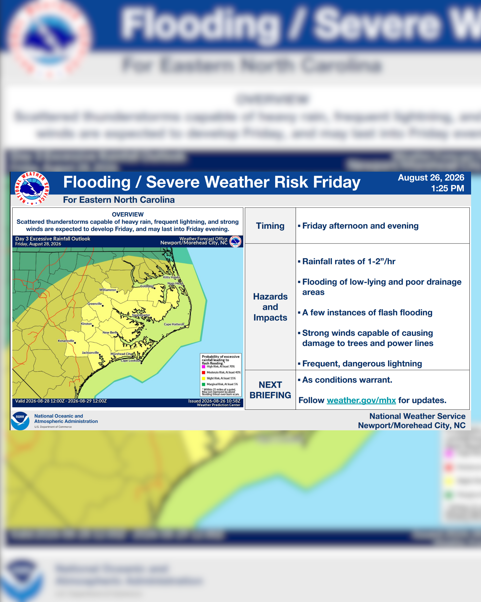
We continue to monitor the potential for heavy rain, flooding, and severe thunderstorms across parts of ENC on Friday, August 28, 2026.
NWS: We are monitoring the potential for heavy rain, flooding, and severe thunderstorms on Friday, August 28, 2026.
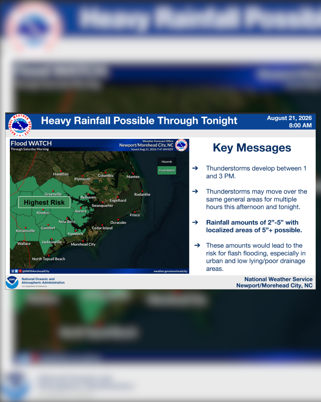
Please ensure you have multiple ways to receive warnings and communication even after you head to bed.
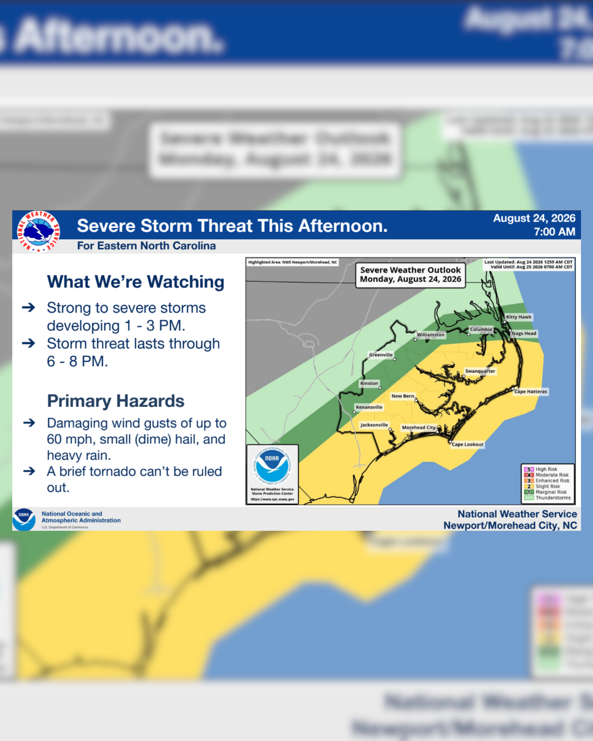
Strong to severe storms are also a threat, primarily this afternoon and evening, with the highest risk also from New Bern west. The main risks are damaging winds of 60+ MPH, but quarter sized hail and a tornado cannot be ruled out.
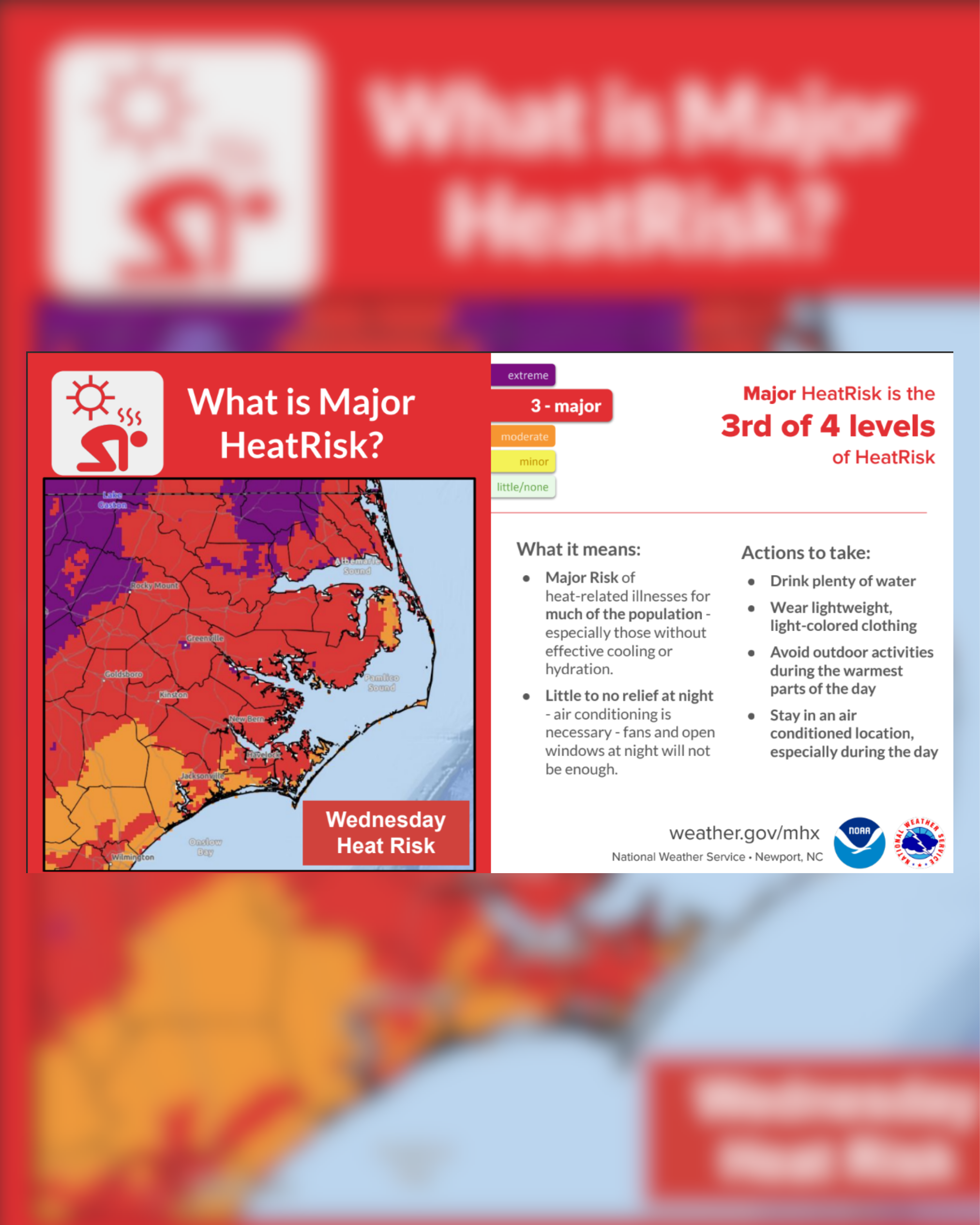
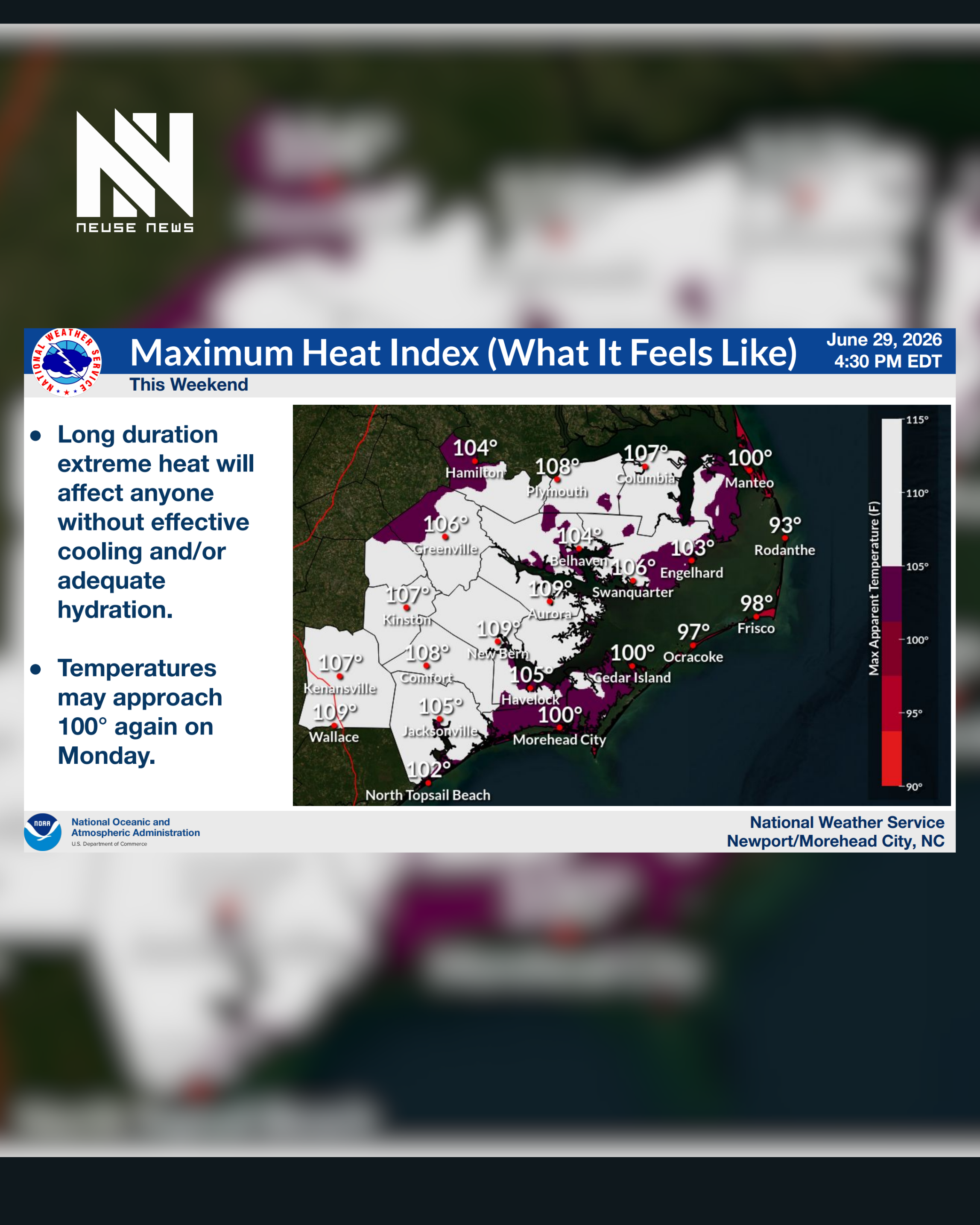
This will be prolonged and expected to have extreme impacts for the majority of our area this weekend, coinciding with the 4th of July celebrations.
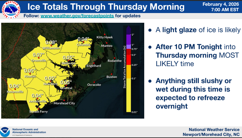
Rain today combined with high temperatures well into the 40s should bring some good melting. Unfortunately colder air moves back in tonight into early Thursday.
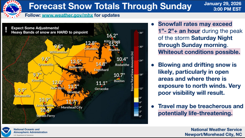
Winter Storm Watches remain in effect for all of eastern NC with the potential for significant accumulating snow.
Winter Storm Watches have been issued for eastern NC with the potential for significant accumulating snow.
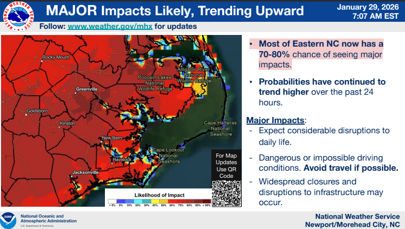
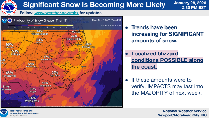
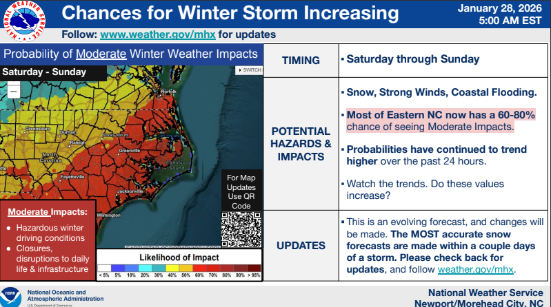
While it remains too early for specific snow accumulations, the likelihood of at least moderate to major (significant snow accumulations) impacts continues to increase.
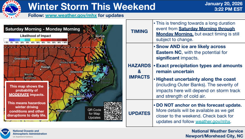
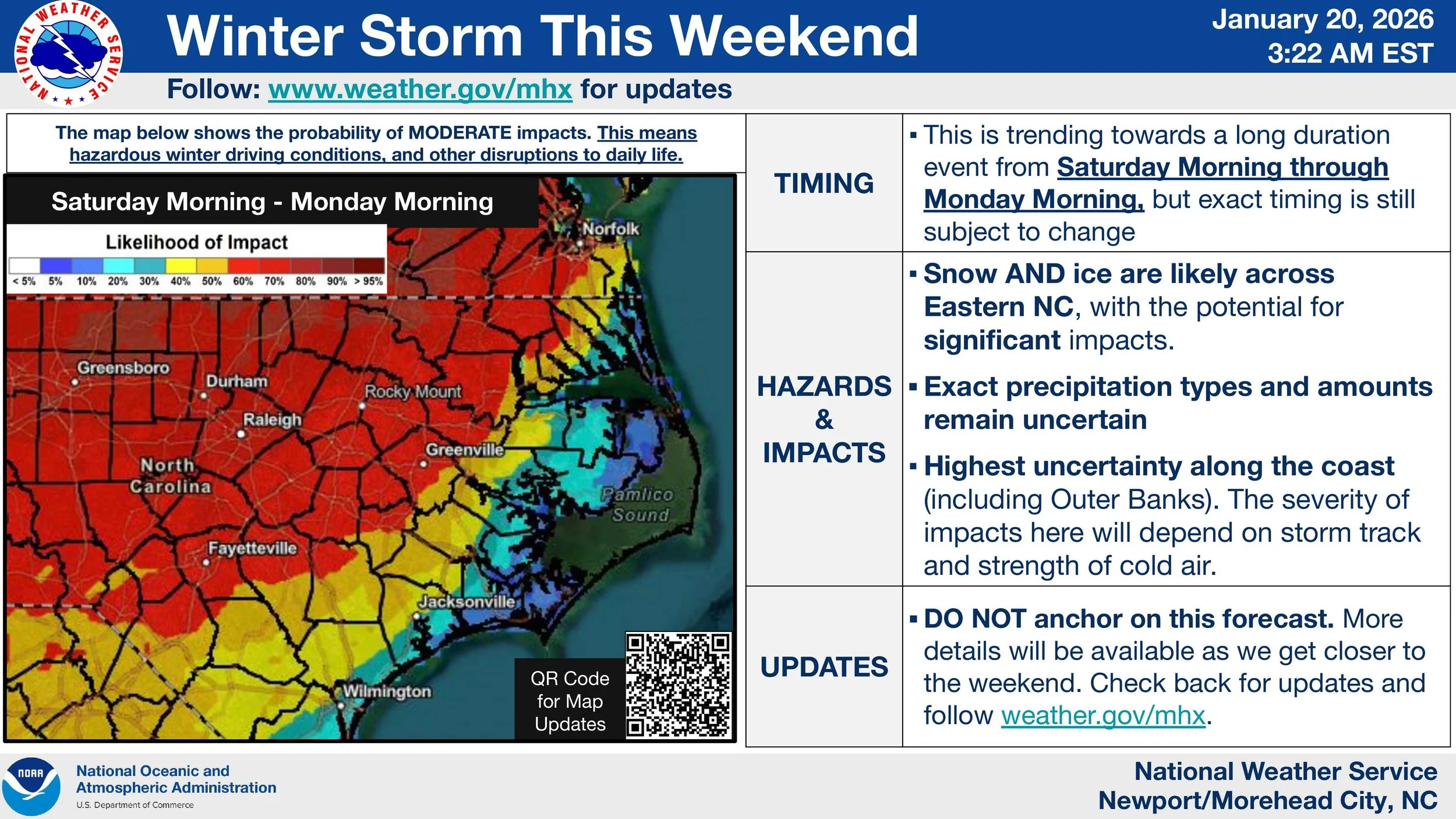
We continue to hone in on the potential winter storm this weekend. While it remains too early for specific snow accumulations, the likelihood of at least moderate impacts is growing.
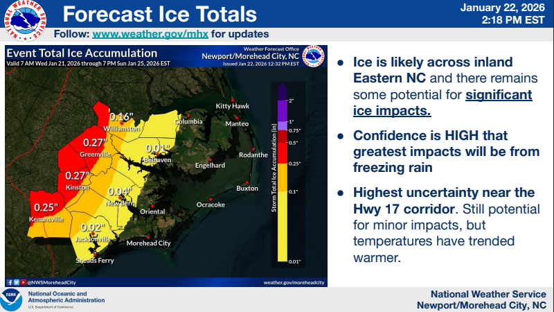
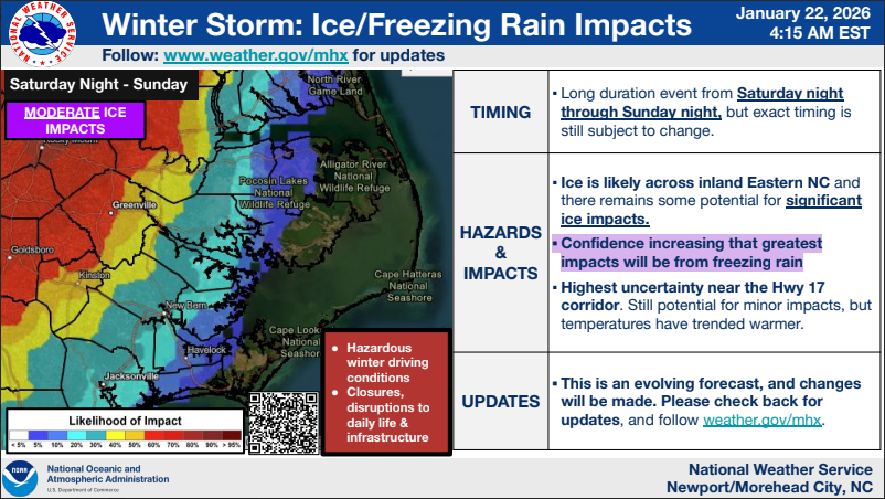
Increasing confidence that the greatest impacts within our area will be from ice accumulation due to freezing rain.
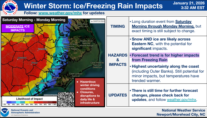
The biggest changes this morning are increased confidence in ice and freezing rain impacts, and lower probabilities of snow impacts for most, except those along and north of US 264.
It remains too early to pinpoint amounts or where specific precipitation types will set up, but potential continues to increase for significant impacts this weekend into next week.
Confidence continues to increase for a winter storm to unfold across Eastern NC this weekend.
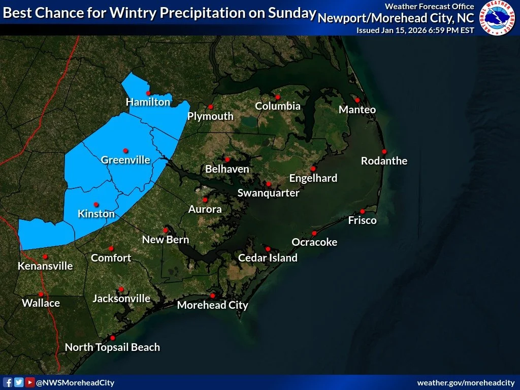
There's still a lot of uncertainty with the potential for wintry precipitation on Sunday. The trend in the models has been towards more rain rather than accumulating snow for the majority of ENC. However, areas west of Highway 17 have the highest chances at seeing wintry precipitation.
Local news delivered to your inbox every day at 7am. Free, always.