Tuesday Morning Update from NWS: Tropical Storm Debby - Heavy rainfall, flash flooding greatest threat for ENC
What has changed:
Very little; slightly faster storm movement later in the week but the track and intensity forecast remain fairly similar to the last update.
What remains the same:
Heavy rainfall bringing the threat of flash flooding continues to be the greatest threat for ENC.
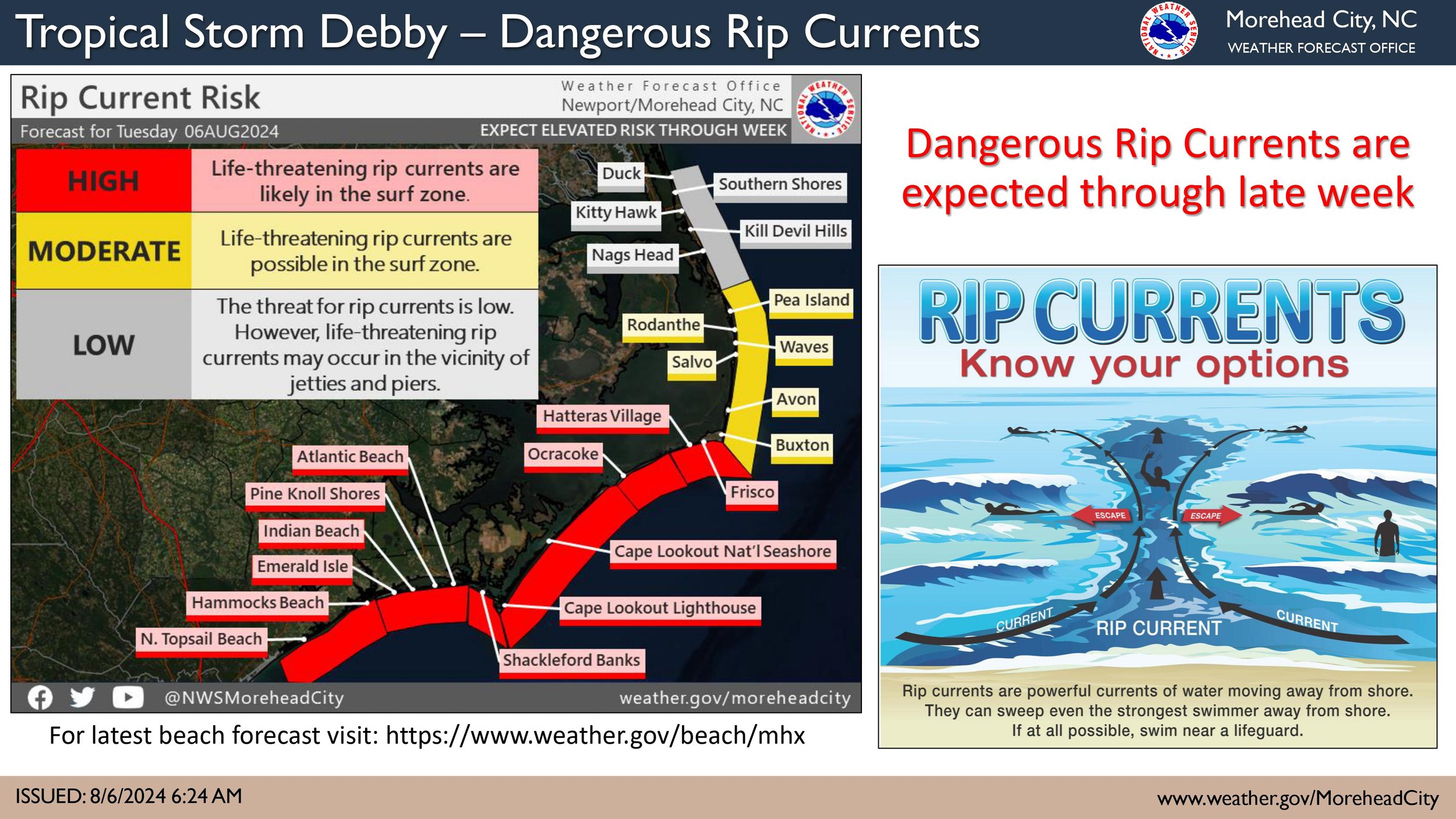
Dangerous rip currents will also be a threat throughout the week into this weekend.
River flooding may become a threat late in the week and into next week after several days of rainfall.
Hazardous boating conditions will develop over southern waters today expanding northward tomorrow and continuing through the week.
Uncertainty continues:
Uncertainty remains with the track and potential additional impacts beyond tomorrow due to weak steering currents in the upper atmosphere.
Debby is forecast to slowly move just off the Georgia coast through tomorrow and make landfall along the South Carolina coast early on Thursday.
The amount of time and distance Debby remains off the Southeast coast will determine how much restrengthening occurs and ultimately the level of impacts we may experience from additional hazards, including Wind, Tornado and Storm Surge.
It is imperative that we keep a keen eye on the official forecast track while Debby meanders over the Atlantic.


