Impactful weather on Sunday, Monday and Tuesday
Eastern NC will be having impactful weather over the next several days.
1)Today there will be a threat of severe weather. The Storm Prediction Center has expanded the "Marginal" severe weather risk to cover the entire area and upgraded the northern coastal plain (Greene, Pitt, and Martin counties) to a "Slight" risk. The main threats will be damaging wind gusts and large hail. An isolated tornado will also be possible. Torrential downpours will occur in the strongest storms as well. Timing will be from mid afternoon into the evening (3-11 PM).
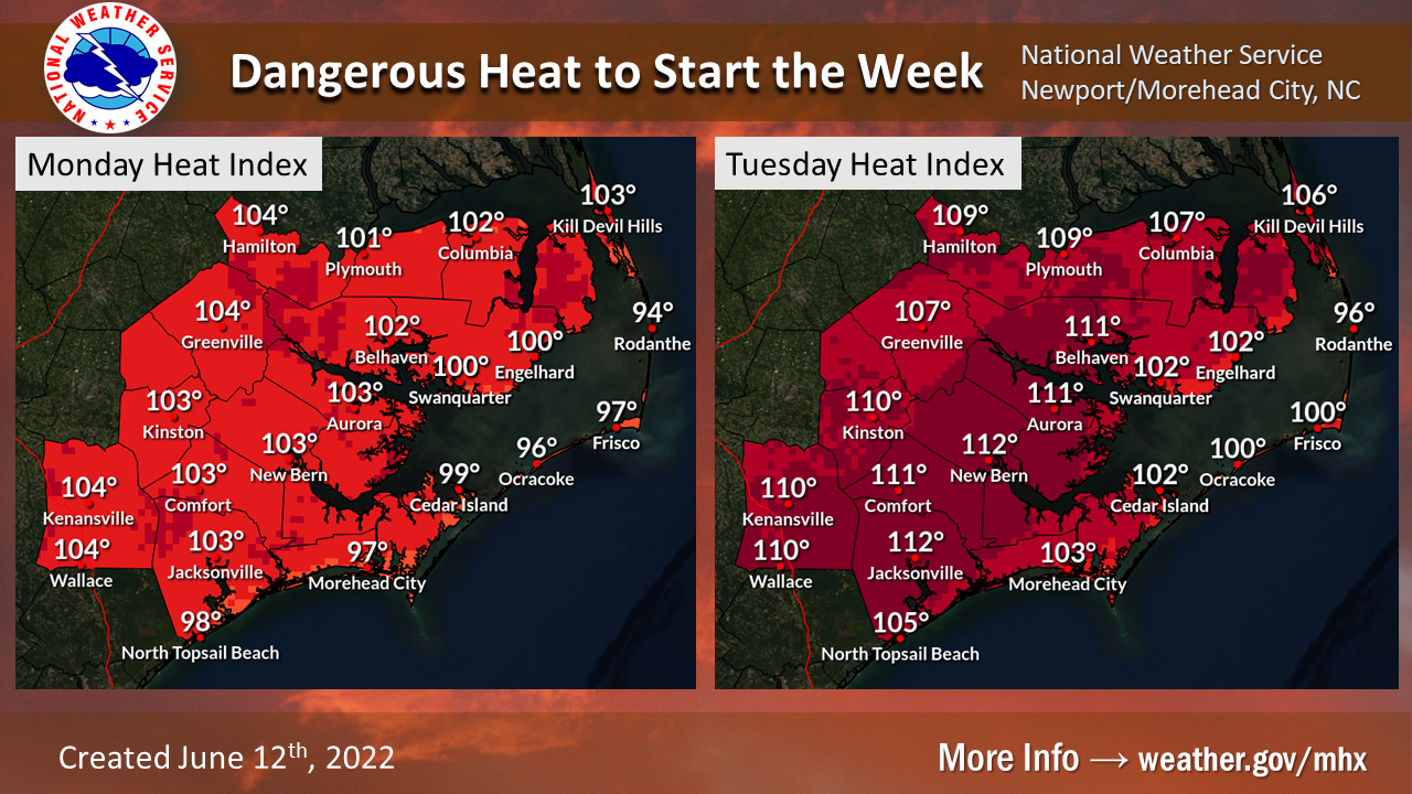
2) Excessive heat is expected across the area Monday with highs in the mid 90s, and especially on Tuesday when high temperatures could reach or exceed 100 degrees inland. The hot temperatures will be accompanied by high humidity producing dangerous Heat Index values. On Monday Heat Index values up to 105 degrees are expected, then increasing to 105-115 degrees on Tuesday.
3) Severe thunderstorms are also possible on Tuesday ahead of an approaching front. There is still a lot of uncertainty regarding the location and timing of the thunderstorm activity but the Storm Prediction Center has issued a "Marginal" severe weather risk for our area.